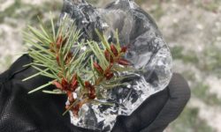
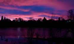
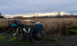
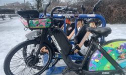
Twin Bridges Scenic Bikeway

Deschutes River(dramatic weather over the Deschutes River near Bend, Oregon)

The background

Ever since I went to the Scenic Bikeway conference back in April, I’ve been itching to ride around on the bikeways I haven’t seen yet. Combine this with a recent intense desire for adventure and newness and open roads and non-mechanized space, and you have a recipe for stasia-in-foreign-lands.

I took two days to hang out in the Bend/Sisters area, camping at Tumelo State Park (which has a $5 hiker/biker site, $21 regular tent sites along the Deschutes River, and $39 yurts) and exploring some of the four Scenic Bikeways that go through the area.

The ride

The Twin Bridges Scenic Bikeway starts and ends in Bend, OR at Drake Park. It’s right downtown, which is handy not only for pre-ride fueling but also for all the post-ride food and brewery options.

Drake Park(Drake Park is on a dammed part of the Deschutes River, and, like all things around Bend, offers amazing mountain views:)

The ride itself is a 36.2 mile loop that does, in fact, take you over the Deschutes River twice, over twin bridges (you can find the map, cue sheet, and other details at the Ride Oregon Ride site). The roads are pretty quiet, traffic-wise, except for a short (.3 mile) stint on Highway 20 and the initial road out of downtown, both of which have good shoulders. And actually, this isn’t mentioned on the cue sheet, but Galveston Road, the road out of Bend, has a parallel and separated bike path that you could take instead of the road itself.

There are only a few parts of the whole route where you can’t see mountains. The Three Sisters are the most prominent, but Broken Top, Jefferson, and Washington all make appearances at some point or another.

sisters on the bikeway(mountains: typical bikeway scenery–in this case, north and middle sister:)

Combined with the high desert Ponderosa Pines, the river, the fun geology, the quiet if somewhat roughly paved roads, and the decidedly un-Portland landscape, it makes for a very nice ride.

Though mileage-wise you could finish the whole route in 2 or 3 hours, I had a really fun time making stops along the way, both to take pictures and to hang out in places that seemed fun. Shevlin Park, for example, is a lovely place that you pass twice on the loop. Tumelo Creek, quite cold, runs through it, and there are miles of running, hiking, and mountain bike trails to explore. It was an excellent snack-and-explore stop for me, and even though I could only wade into the creek for a few seconds before my feet turned numb, I still had a good time wading in, then out, then in again for as long as I could handle it:)

There are also tons of places just to pull off the road and marvel. Or watch birds. Or count clouds. Or do whatever it is you love about being in nature. Which, without consciously knowing it, is exactly what I needed out of an adventure.

The other cool thing, something that I noticed when I was biking through here on my way to Tahoe last year too, is that people in Bend seem pretty used to both seeing and being cyclists. Everyone I met was friendly and courteous on the road, which always makes for a more pleasant experience.

crows feet bike(and right at the end of the bikeway, not only do you go right past Bend Brewing Company but you also pass this awesome bike/coffee/beer/hangout place right at the edge of the park:)

But the best part…

But the best part isn’t the amazing views, the good biking, the cute downtown Bend shops, or the sense of openness and possibility out here. It’s that if you’re out near Bend for this bikeway, there are three others not too far away: the McKenzie Pass, Metolius River, and Sisters to Smith Rock bikeways all start near Sisters just over 20 miles away from Bend. It’s a bikewaystravaganza out there in central Oregon.

I have plenty more pictures, of course, both of the bikeway itself and all the fun stuff you can access from Tumelo State Park. Check them here if you want to get inspired for your own adventure:)

Breakfast at PNCA

Yay! On my way to work yesterday I found my way to a Bike Month breakfast, on NW Johnson and NW 13th, right in front of Pacific Northwest College of Art. There were a few excellent things about it:

  1. It’s a free breakfast for people on bikes. That’s pretty awesome in and of itself
  2. It was actually a breakfast! Not just coffee and donuts, I mean (though there was definitely that too), but also bananas, granola, yogurt. A whole spread!
  3. They even had Metro seat covers, stickers, and other fun things to give out:)
  4. It was well attended by a wide variety of people, and everyone was in a good mood. A great way to start the day that, hanging out with other happy people

NW johnson bike month bfast(Woohoo! A colorful bike breakfast! –And check out the awesome vertical bike parking behind them:)

The best part, though, was one of those fuzzy little community-building type things. As I rolled up, I immediately recognized one of the women hosting it. But from where? She recognized me too, so we rolled through the basic how-might-I-know-you? routine. But you know what? It turns out that we just know each other from last year’s bike month. We chatted for a long time on NW Johnson last year, and that’s it.

We do have some friends in common, though (which is typical of Portland, I suppose;) and we decided this year that it’s amazing that we aren’t already friends in our own right. As I left, I couldn’t help but say “I’ll see you again on Johnson next year!” heh. Hopefully we’ll see each other again before that, but I love the random little connections like this that spring up when you’re willing to slow down and talk to people. Which is ever so much easier when you’re not traveling through the world in your own little metal box, cut off from everything. Just sayin’ ;)

There’s another breakfast tomorrow, up in St Johns for all you way northerners. And more throughout the month. Hit one up! They’re awesome!:)

Ronde PDX: Portland hillstravaganza!

Who likes hills? This chica does! And if you do, too, I sure have a ride for you.

It’s an amazing ride. It will take you up all the Portland hills that you never knew about. It will try to break you with the steepest of the steep. It’s amazing. And, pardon the coarseness, but I couldn’t help but think as I was riding that this route is very similar to good sex. More on that later.

I didn’t come up with it, though I certainly would like to meet the person (or people) who did. So what is it? It’s the Ronde PDX, a 47(ish) mile ride with about 4700 feet of elevation gain, all of it on super lovely roads that make you appreciate how much more slowly you go uphill.

If you look at the website, you’ll see that there is an “unofficial” day where people do the ride en masse (that day happened to be the same day as the 3 Capes 300k this year), but the cool thing about it is that you can really do it whenever–just follow the Lion of Flanders.

lion of flanders(the lion points the way toward Council Crest, the ride’s end point)

Especially now, since the ride just happened, the paint is fresh and easy to follow. Aside from a marker I missed turning onto Highland Parkway near the zoo and a marker that’s pretty conspicuously painted over to indicate a right turn off of Sherwood Road, I had no problems with it. (Big thanks to my routefinding buddies who answered their phones when I called for directions–the hazards of not having a smartphone with maps;) Thanks James! Thanks Mark!:)

There are a few unpaved parts. The longest is right near the start, the climb up Saltzman Road, but there are a few others that go both up and down. With my itty bitty skinny tires I always worry about unpaved, but everything held up fine. I definitely wouldn’t let the unpavedness stop you.

saltzman road(behind the gate: Forest Park and the first totally beautiful and unpaved climb)

You seriously need to like hills to enjoy this ride. At least, if you’re not doing it on the real ride day in solidarity with a whole bunch of other people whose presence may give you some entertainment and encouragement, you should probably go into it hoping to ride up. And here comes the part about why this ride is like good sex.

So I knew the end was Council Crest, but without a cue sheet or GPS or anything, I never really knew how much more of the ride I had left. So starting as early as 24 miles in, when you turn onto Hewitt toward Council Crest, I felt like I was always heading right toward the end–the climax, if you will–and then just as I got near it taking a turn that spewed me all the way downhill again, only to start over climbing to the top. There are 4, 5, 6-maybe times where I was so close to Council Crest and then the route zoomed me all the way down somewhere else. Such a fricken tease, but of course only serving to make the end all the more sweet.

Though that’s also why if you’re really not into hills this ride will kill you, because over and over it takes you so close to where you want to be–and then breaks your heart by turning you not only further away, but downhill again, ensuring that you have to make up all the same elevation over and over and over.

It’s awesome:)

Today was such a beautiful day for this kind of ride. Because you’re often pretty high up, on a sunny day you get spectacular views along the whole route of our four visible mountains: St Helens, Rainier, Adams, Hood. And then at the end you get all four of them at once at Council Crest.

trek hood n trolley(the trifecta of awesomeness at Council Crest: my lovely bike, Mt Hood, and random Portland trolley:)

The whole ride, complete with routefinding and picture-taking stops, a detour to scope out Pittock Mansion, a lunch/lie in the afternoon grass break at Harrison Park, and another detour when I ran into Michael Wolfe out for his own lunchtime jaunt up Council Crest and turned around to bike with him for a while–complete with all that, the ride took (I think) about five and a half hours. Which seems like a reeeeeeally long time for, oh, 47 miles. But I guess it was pretty darn hilly, and I was just out for a day-off joyride.

Though the sobering thing: in July, I’ll be doing the Death Ride down near Lake Tahoe. Which is 129 miles–almost 3 times as long as this ride–with 15,000 feet of climbing. All at elevation. heh. I’m going to have to get crackin’ on this spunky hill-climbing! :)


May is bike month!!

And that means that the Portland Bureau of Transportation, along with other celebratory things, is serving free breakfast to cyclists all over the city!

You can find their full complement of Bike Month information here, but here’s the breakfast schedule at least (cuz let’s face it, food is important!):

  • May 2 (tomorrow!): 6:30-8:30am at SE 130th and Center
  • May 7: 7:30-9am at Pacific NW College of Art (NW 13th and Johnson)
  • May 9: 7-8:30am at St Johns Plaza (N Lombard and Philadelphia)
  • May 14: 6:30-8:30am at the I-205 Multi-use path and E Burnside
  • May 15: 7-9am at Hillsdale shopping center (6344 W Capitol Highway)
  • May 16: 7:30-9am at SE Lincoln and and 39th
  • May 21: 7:30-9am at W Barbur and Hamilton
  • May 23: 7-8:30am at NE Sacramento and 67th

I’m psyched that they’re really reaching out to different parts of the city. A lot of bike-fun type stuff happens pretty close to downtown–which I guess makes sense if you’re simply trying to reach the highest number of people–but it’s nice to acknowledge that people do, in fact, come by bike from all over this city.

Let me know if you stop at any of these! I’ll probably pedal by the SE breakfast on May 16, but I’d love to hear how the other ones go if you happen to be by!

(And by the way, May 17 is National Bike to Work day. Do it!:)