
Saturday! Valentine’s day! I’d planned to spend the day biking, since I thought I would ride the Oregon Randonneurs’ 200k route. But when I looked at the route they had planned, I noticed it was an out-and-back on many roads that I’ve already ridden on a bunch, and I was more in the mood for an adventure. So last minutely, I decided to switch it up: take a ride on roads I didn’t know, try to stitch together some fun multi-use paths, and make it a loop that started and ended at my front door (i.e. did not necessitate transit out to a starting point).
The result was this gem:
At about 105 miles and 7400ish feet of elevation gain, it felt like a good day’s work; with the plethora of roads I’d never been on it felt like a giddy adventure; with the little-traveled, middle-of-nowhere unpaved routes and several different multiuse paths, it felt like a retreat from normal life. All told, it was a fantastic way to spend the so-called day of love with my bicycle.
I borrowed heavily from a route I read about over at Urban Adventure League when Shawn and some others made a loop from Hillsboro through the Chehalem “Mountains” — which I put in quotes because the highest point, Bald Peak, is only a little over 1600 feet. (You can see their 53-mile route here). I was intrigued by the idea of unpaved and untrafficked roads through the mountains, and I was definitely intrigued by the fact that many of the roads they traveled were mere hints of lines on my new Washington County Bike Map.
 (this map. This map rocks)
Since I didn’t want to take transit, since I’m always looking for a better way to bike to Hillsboro, and since I was in the mood for unpaved and away from cars, I opted to get out to Hillsboro by way of Forest Park and the Rock Creek Trail — not exactly a pragmatic way to get there, but definitely lovely. Saltzman Road through the park is one of my favorite hills, and early on a Saturday morning there was (surprisingly!) no one out there.
 (just me and my bikey on Saltzman Rd)
The Rock Creek Trail was also a pleasant surprise. Every time I happen to be out there (which is not often), it’s better: more protected crossings when it runs into major streets, more wayfinding signs, more bike-friendliness. Also, tons of people out jogging and biking and walking, which always feels wholesome.
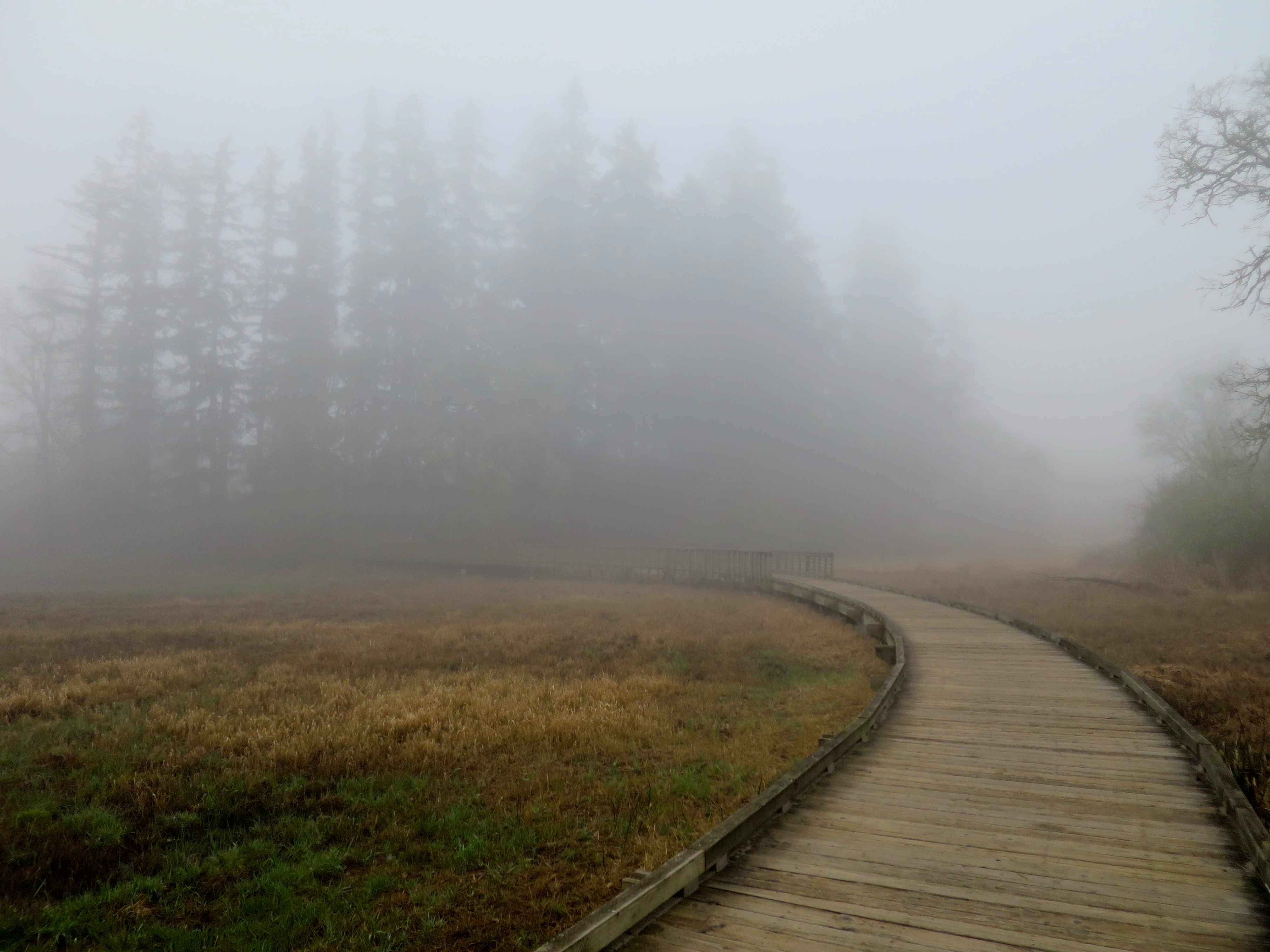 (plus, it has this rad boardwalk!:)
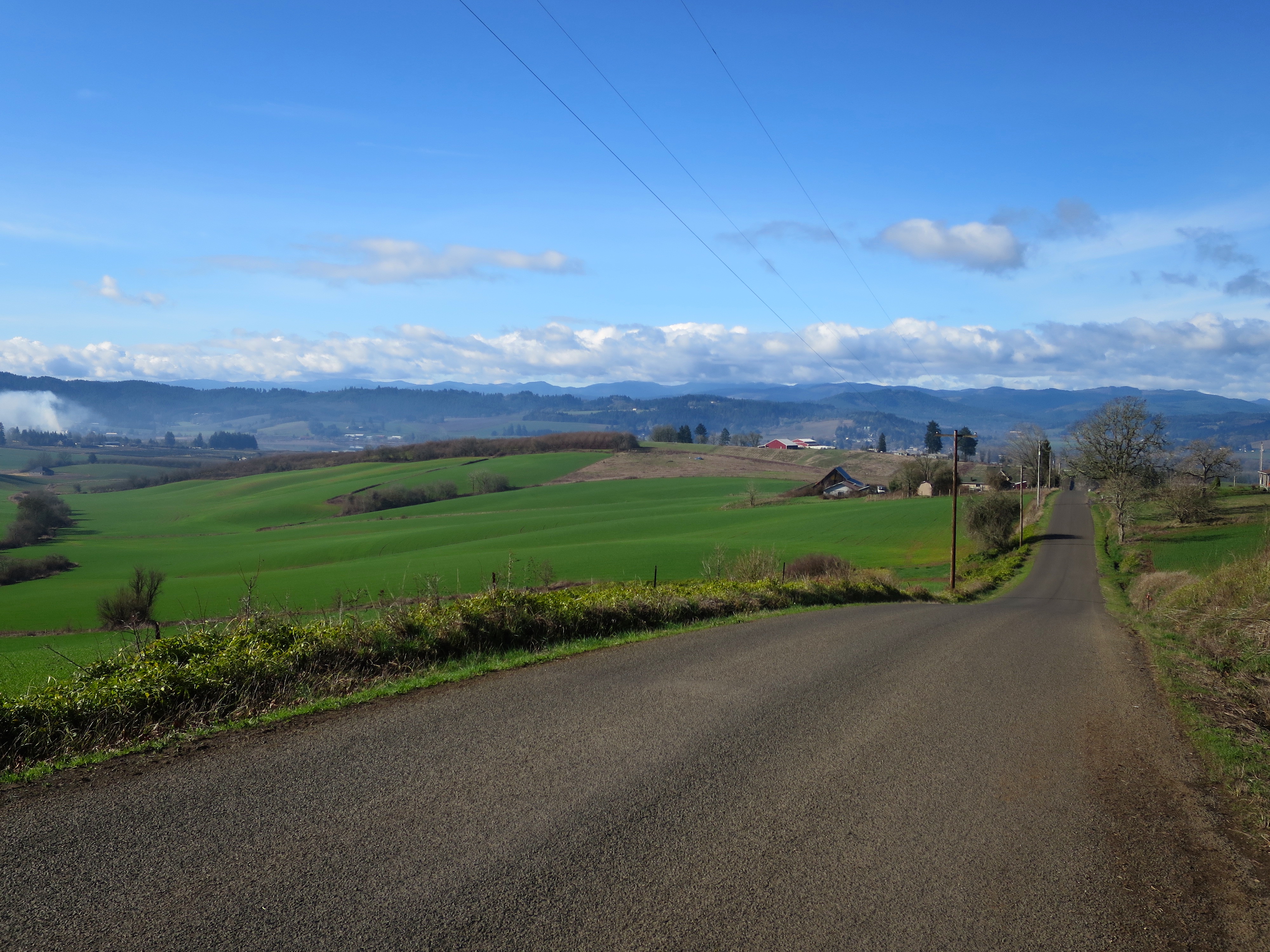
The Rock Creek Trail led me to Hillsboro proper, which would have been a good stop for food or beverage. Instead, I kept going, taking note of the super lovely and very full Jackson Bottom Wetland Preserve for future exploration and birdwatching. And once I turned off Hillsboro Highway (not as scary as it sounds), it was little roads all through the mountains, varying degrees of paved and unpaved.
.
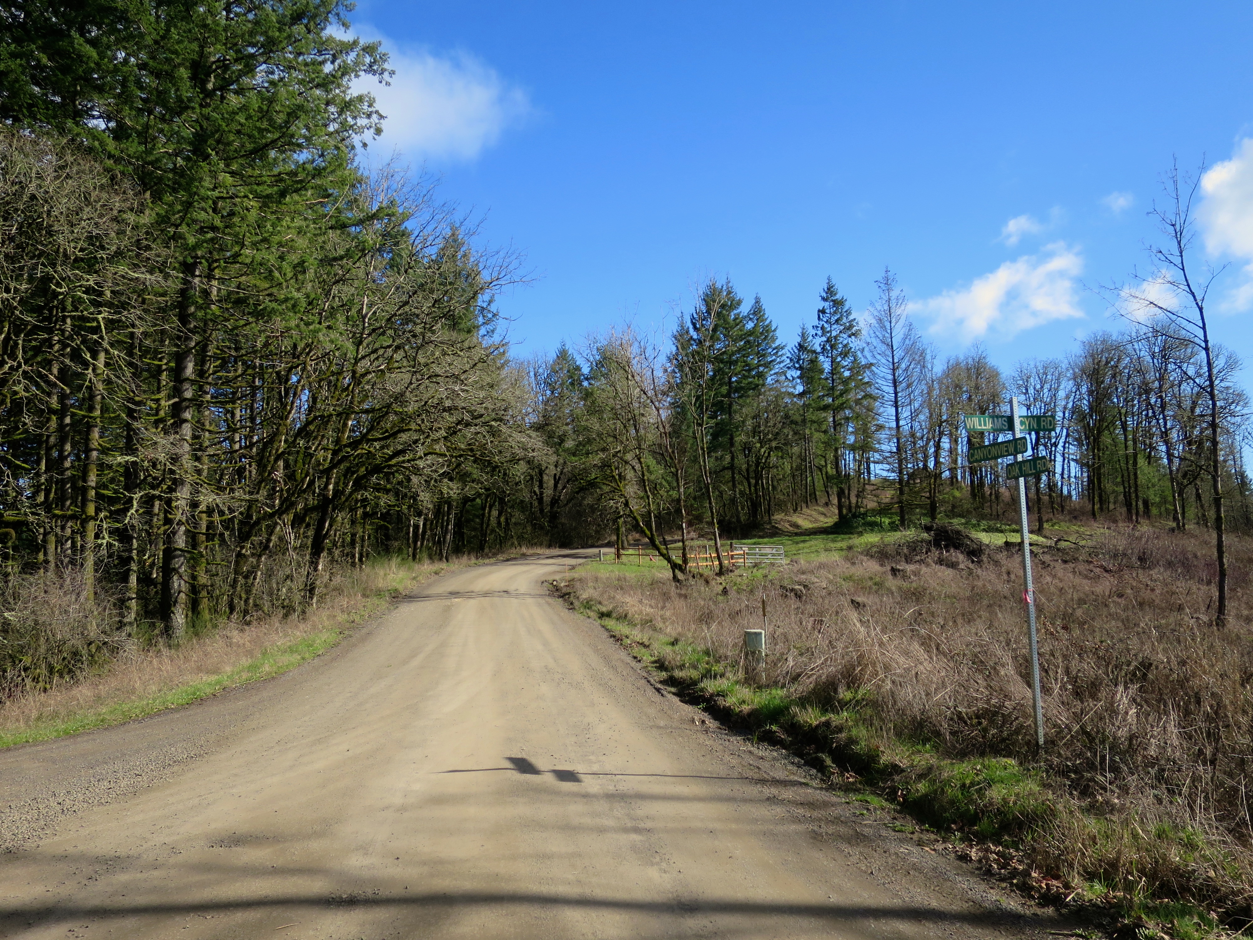
I always feel like unpaved roads are a bit of a wildcard. My bike, with its 28mm tires, does not exactly float over rough surfaces the way a mountain bike would — but it handles just fine so long as the road isn’t deeply sandy or full of big rocks. The wild card aspect is more about whether it will be pleasant to bike and I’ll be able to enjoy the scenery, or whether I will have to give all my attention to the road in front of me to keep from falling over. There are many different flavors of unpaved road, and though there are certainly different flavors of paved road as well, the difference between paved and shittily paved is much smaller than the infinitely many ways an unpaved road can be rocky, sandy, muddy, passable or totally hideous.
 (now THIS is idyllic unpavedness)
Mostly, this ride was on the pleasant spectrum. The roads were a little wet and mucky still despite the sunshine, but not enough to significantly gunk my bike. Mostly they felt like slightly damp, hard-packed dirt and were lovely to roll on. The only exception was South road, just west of Gaston, where if I had to guess what happened I would have to say a giant truck dumped about 60 million tons of 2-3inch pointy rocks all over the road. For like three miles. (I assume this was to resurface it, or maybe add some traction to the muddiness of it, but it sure was crappy for biking, and I was kind of worried I would flatten both my tires.) As it seemed more and more likely that I might actually shake my teeth out of my head (or knock them out when I fell over), I definitely started to wonder if I should turn around and stick to paved roads, especially if the rest of the ride was going to be like this. But I decided to trust that it would get better, and luckily it did. By the time I turned onto Williams Canyon Road, it was smooth sailing.
 (much more civilized:)
I won’t do a blow-by-blow of this whole ride or anything — there were many miles of it, after all, and you can look at the map for details if you’re curious — but I’ve gotta say, going through the Chehalem Mountains was pretty fricken rad. The unpavedness of it constantly made me feel like I was on the edge of the illicit but in a good way, like I was biking up someone’s secret driveway or something rather than on a public road. (The random houses along the way only added to that perception.) And it’s hilly in the best of ways, enough to keep it interesting but not crazy hard — with the possible exception of the unpaved Anderson Road, which had some pretty darn steep parts near the top, steep enough that without a lower gear they were almost too steep for me to have traction.
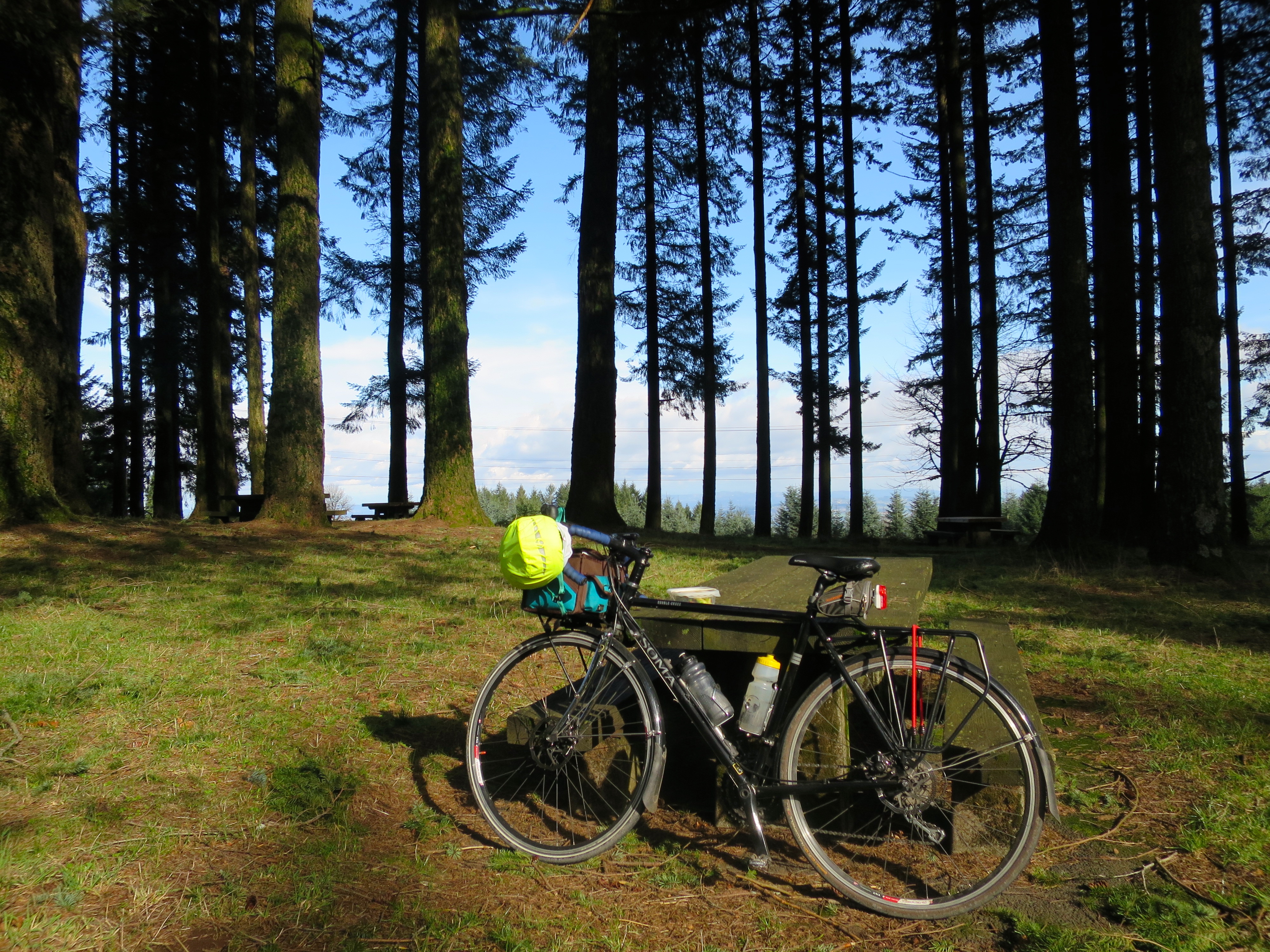 (after Anderson Rd, a lunch stop at Bald Peak, highest point of the ride)
.
Coming down from Bald Peak, I made a wrong turn and inadvertently ended up on Hillsboro Highway again instead of the continuation of Mountain Top Road — at least, I think that’s what I did. You know those moments where you come to a road that you don’t expect to see, so you look down at your map, then back up at the signs at the intersection, and you have a really hard time matching the reality of the intersection signs to the image of where you thought you were? That was me. But whatever I did, I eventually ended up where I wanted to be: the best slightly-direct way I could figure to get from the Newberg area to Lake Oswego. Unfortunately, that way involved a little bit of biking on 99W and a little more on the busy Tualatin-Sherwood Road, because apparently there’s a dearth of connecting back roads in that area. Bummer for biking.
Regardless, it wasn’t too bad of a ride to Lake Oswego, which is where I lived 10 years ago when I bought my first and still-extant road bike, the racey Trek that spawned my earliest bike adventures. As I got closer, it was fun to have my 10-year-old muscle memory kick in about the roads I used to wander. It was also helpful, since I hadn’t actually planned that part of my ride, figuring that once I got close enough I could just wing it.
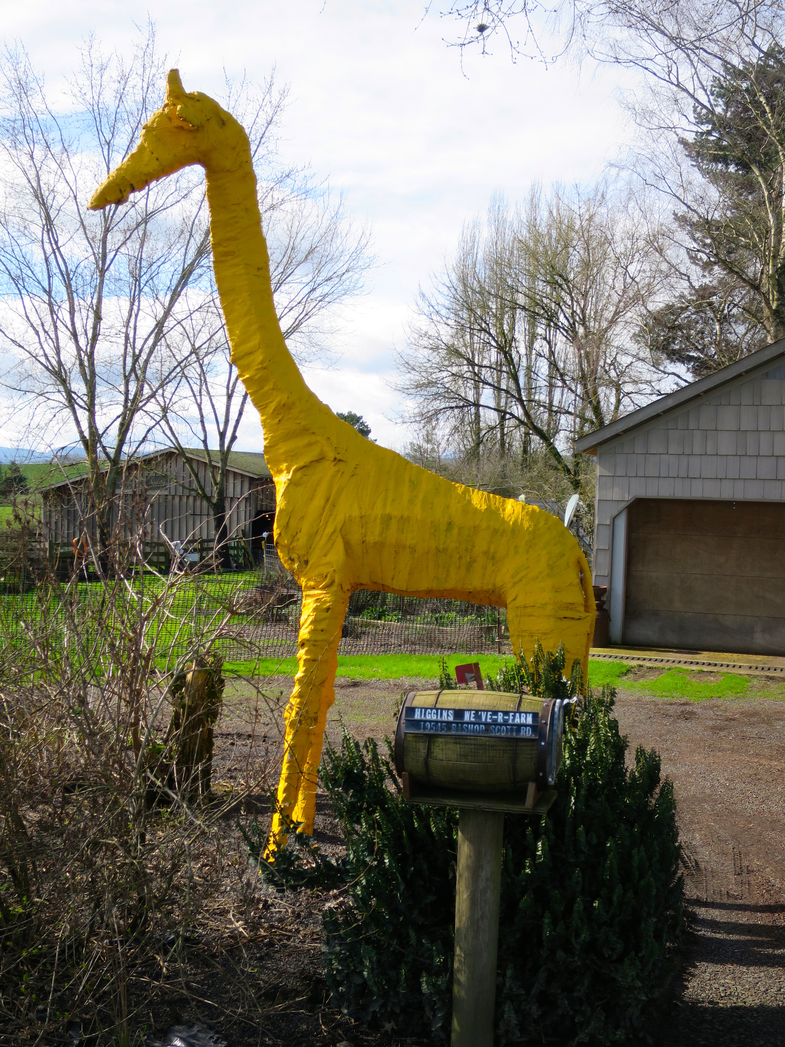 (oh, did I mention I saw a giant giraffe?:)
More adventures ensued, including discovering the “Iron Mountain Bikeway,” which I think might still be in the process of being built (or maybe you’re just supposed to bike scarily on the wrong side of the road for a while?), the Tryon Creek State Park bike path (always lovely), a good look at the continuing Sellwood Bridge construction, and a classic ride down the Springwater Trail. (More pictures here!:) All in all, it was an excellent day spent exploring by bicycle, and, an excellent alternative to ridiculous Valentine’s Day consumerism. heh. Everyone wins! :)