
A super awesome thing about Portland that I don’t take advantage of nearly enough is its relative proximity to the ocean. In less than 80 miles, you can get to bunches of different places on the northern coast, all of them beautiful. And to make it even better, there are lots of super lovely, even relatively low-traffic ways to get there on a bicycle.
The Portland Bureau of Transportation has three helpful maps, complete with turn-by-turn cues, to take you to Astoria, Tillamook, or the Three Capes Scenic Loop:
As of this last week, I’ve taken all three of them. They all offer a different sort of ride, but they’re all nice. Worth noting: all three of these routes start not in Portland but at the last Hillsboro MAX station, and the mileages don’t actually take you all the way to the coast. They do take you to nearby places where you can hop on Highway 101 to get to wherever exactly on the coast you want to be, usually within 10-15 more miles. Something to think about when you’re planning how far you want to go in a day–it’ll be a little bit extra to actually see the ocean.
Route 1: To Astoria
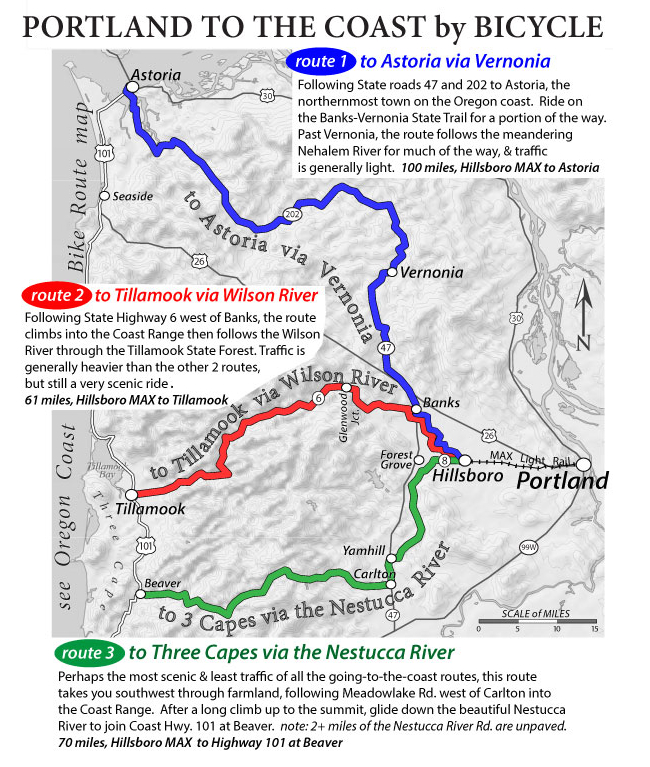
This route is the longest of the three and the once I’ve traveled the most. It takes advantage of the excellent Banks-Vernonia trail–20 miles of multi-use, car-free path–and then winds along the Nehalem River. At first I was intimidated by the fact that I would be biking along Highway 47, which I thought would be really busy, but the PBOT site is right when it says that traffic is usually light (and there’s a shoulder and share the road signs:). And Highway 202 is absolutely beautiful.
 (the Nehalem River, which you cross about 5 gazillion times:)
Also, there’s not much climbing to speak of on this route. You do go over the Coast Range, but it feels more like going over a moderate hill: by the time you’re tired of climbing, you’re at the top. Most of the time is a fairly flat ride along the river.
Plus, this route has the added bonus of ending in Astoria, somewhere that’s super cute in its own right. Even if it’s not on the ocean, it is right on the Columbia River just before it dumps into the ocean, and there’s an awesome riverfront path, great (and hilly:) walking and biking through the city, plus a delicious brewery, an awesome cafe with copious vegan options, the house that The Goonies was filmed in, and lots of other cute things just waiting to be discovered.
You can find pictures from two of my bike trips out to Astoria here and here. (Plus, a bonus: this is my favorite bike sign ever:)
Route 2: To Tillamook
This is the shortest of the routes, and also the most heavily trafficked. I have to admit I’ve only biked it as part of a much longer ride that I took with the Oregon Randonneurs, the 3 Capes 300k, but I remember being pleasantly surprised by how much less traffic there was than I thought there would be, and how courteous all the people who did pass me were.
Granted, it was fairly early still on a Saturday morning that I was out there. I’m not sure what it would be like at other times. It is super gorgeous though, and also not too much of a hill. And when you get to the top, it feels like you go downhill toward Tillamook forever. Whee!!
Also to this route’s credit, there are places to camp in the middle, in the Tillamook State Forest. I’ve never stayed in any of the campgrounds (chime in, anyone who has), but they seem nice. It might be worth exploring someday:)
Remember, though, this route only takes you to Tillamook (can anyone say “cheese factory??”:). It’s another 12 miles to Netarts, or 10 to Bay City, which are actually on the coast.
Route 3: To 3 Capes
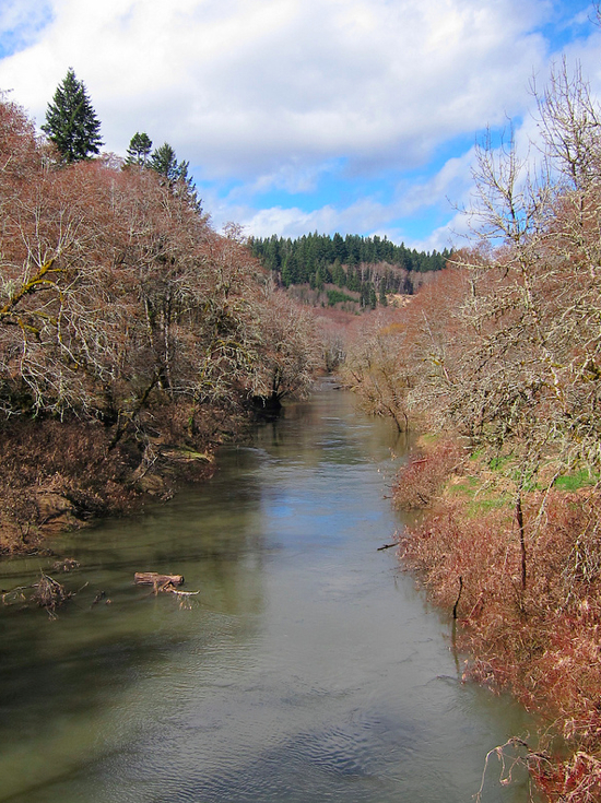
I just took this route for the first time last week and was so super stoked about it. I’d been avoiding it because there are about 3 miles of unpaved road in the middle of the Nestucca River Road, and my racey Trek (especially with a trailer attached) doesn’t handle unpaved very well. But with my new Soma expedition bike (heh), I was so ready to tackle it–and then it turned out that it’s not even that bad and I probably would have been just fine with my Trek all along. So don’t let the unpavedness deter you.
The first part of the route along Fern Hill and Spring Hill Roads is somewhat trafficky with rural fastness, but it’s still pleasant (and beautiful), and once you leave Carlton on Nestucca River Road, there’s basically no one out there. Plus, Nestucca River Road itself is super gorgeous, quintessentially Northwest in the cedar-hemlock-cottonwood tree cover, the myriad ferns, thimbleberry, oxalis, salal, the meandery river. Amazingly, I didn’t take that many pictures of it, but this is right when it turns unpaved:
 (doesn’t that just make you want to take a deep breath of fresh air?:)
Like the route to Tillamook, there are also a bunch of super cute campgrounds right on the river that almost–almost–enticed me to stay one less night on the coast.
Like the other routes, this takes you not all the way to the ocean but to Beaver, OR, a town that consists mostly of a Shell station and a mini store. But from Beaver, it’s only about 11 miles to Cape Lookout State Park, which has an amazing (and only $6) hiker/biker site that is literally a 30-second walk from the beach. I was super happy to get there just in time to set up camp and have dinner on the beach, watching the sun set.
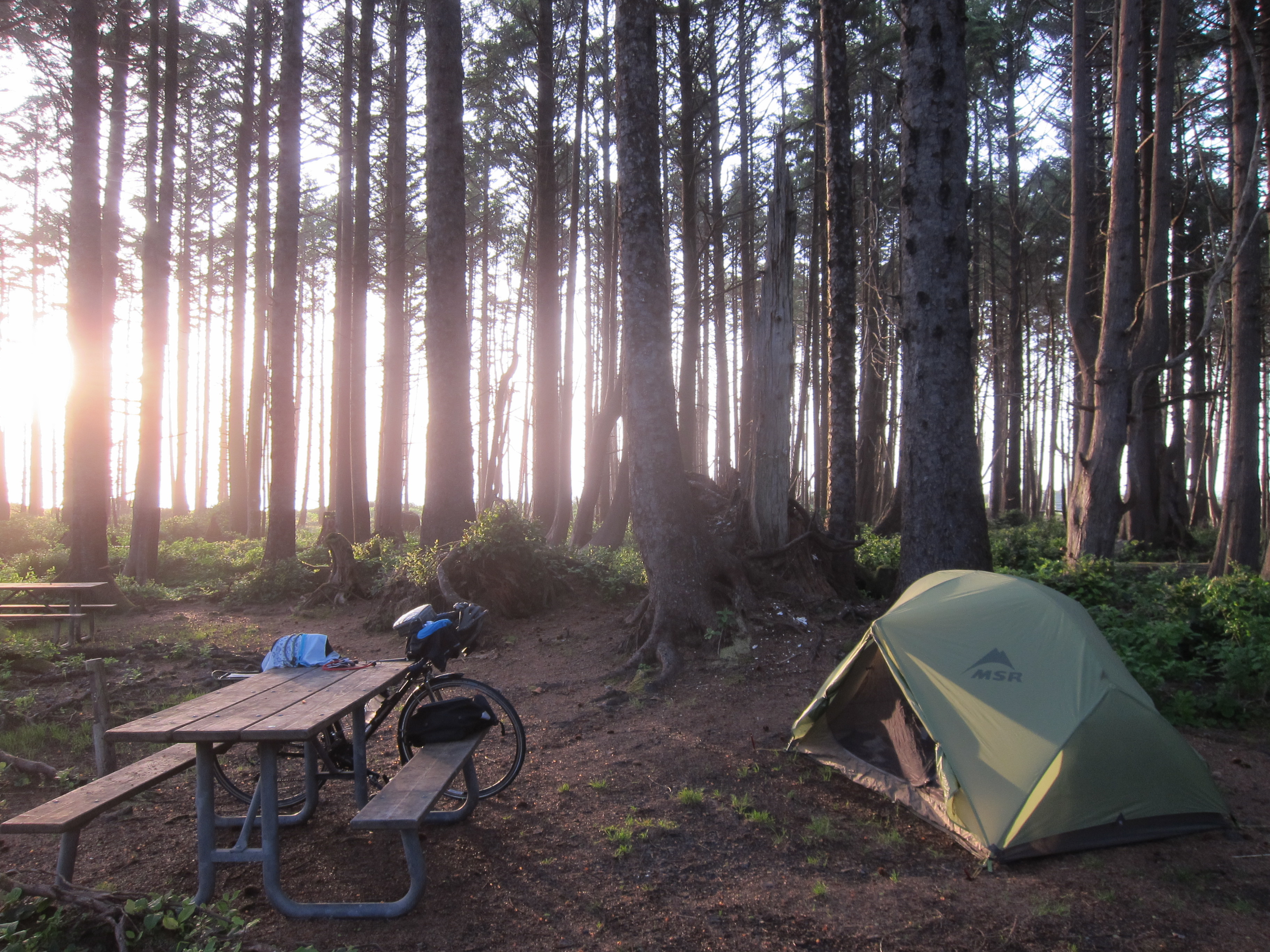 (the Cape Lookout hiker/biker site, as the sun sets)
Also, from Cape Lookout it’s only about 15 miles south to Pacific City, which is one of my favorite places ever, not only because of the Grateful Bread Bakery (motto? “everybody must get sconed” :) And there are great hiking trails out to the end of Cape Looking right from the campground. For going to the coast coast, not just Astoria, this is probably my new favorite route and destination.
You can find more pictures from my trip to Cape Lookout here.
So there you go.
Three awesome ways to get to the coast, all made super easy with the PBOT maps and cue sheets. Are these the only ways to get to the coast via bicycle? Absolutely not. But they’re definitely a good place to start if you’re thinking about trying it. Go for it!:)
You can get to Seaside just as easily as Astoria by following the Astoria route to Olney, going down to Young’s River Falls, and then taking Tucker Creek – Logan – Lewis and Clark roads right into town. It’s VERY pretty, and much shorter, easier, and nicer than going all the way up to Warrenton and then down 101.
My dad, Allison, and I did a 5 day tour out to the coast a couple years ago, and my dad’s an old guy, so we groke up the trip out into 2 days. We took OR 6, and stayed at Elk Creek CG, which broke up the outbound ride nicely. It’s a really really nice campground — incredibly lush and set back far enough from the highway that you really don’t get any road noise. We came back on the Nestucca River Road and similarly broke it up into 2 chunks, staying at Dovre, which is the eastern-most (and in my opinion, nicest) of the 5 CG’s on that road.
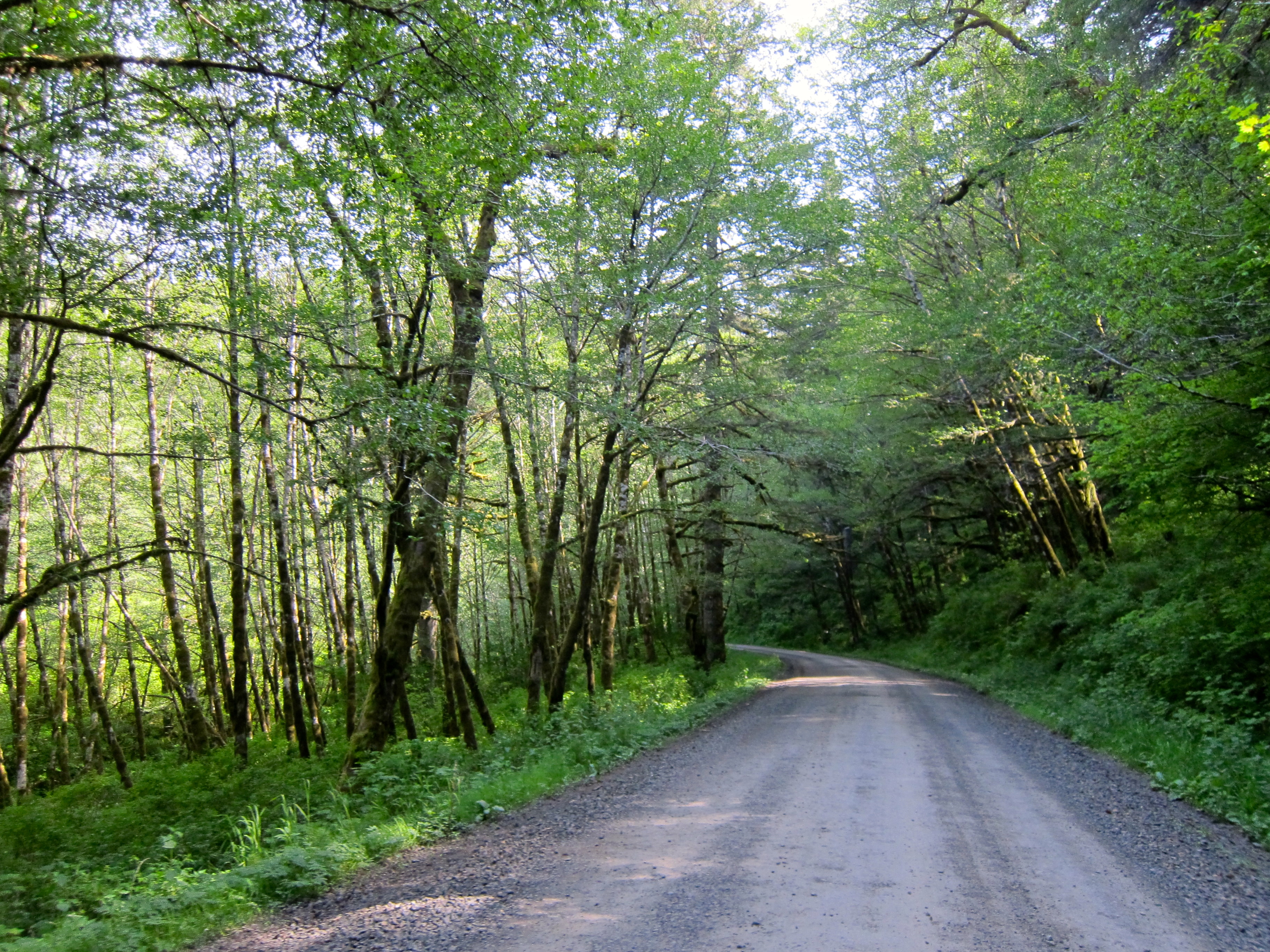
Now that you have a bike with some real tires, I would encourage you to check out Foss Rd, from Elsie down the Nehalem to Mohler. There are very nice CG’s at Spruce Run and Nehalem Falls, and the road itself is beautiful and primitive and a great adventure. Unlike the gravel stretch on the Nestucca, you definitely do need some good rubber on your wheels to navigate that road, though.
Hey Michael!
Good call on the Young’s River Falls route to Seaside. 101 is lame.
And DUDE! I’d never heard of Foss Rd, but I just found it on Googlemaps–looks like it’s called Lower Nehalem Rd to start with? Looks like an adventure waiting to happen:) Though what sort of good rubber are we talking about here, exactly?:) And is the whole thing gravel or just parts of it?