There are some excellent multi-use trails in and around Portland. The Springwater Corridor comes to mind, for example: over 20 miles of awesome, paved, off-street path that will take you all the way from Portland to Boring.
The Springwater’s kind of a pathy institution, a sort of jogging-walking-biking superhighway on any nice weekend. But there are tons of other paths around too. Some are also somewhat longish and can provide actual means of getting places (even if they’re not always super pleasant), like the I-205 or the Marine Drive paths; some, like the Fanno Creek Trail, are nice but just too short to do much for real transportation.
Last week, I found myself on the Rock Creek Trail somewhere around Hillsboro, a lovely path I’d never yet explored, and it reminded me how much of a trail’s success (and usefulness) depends on the infrastructure along it.
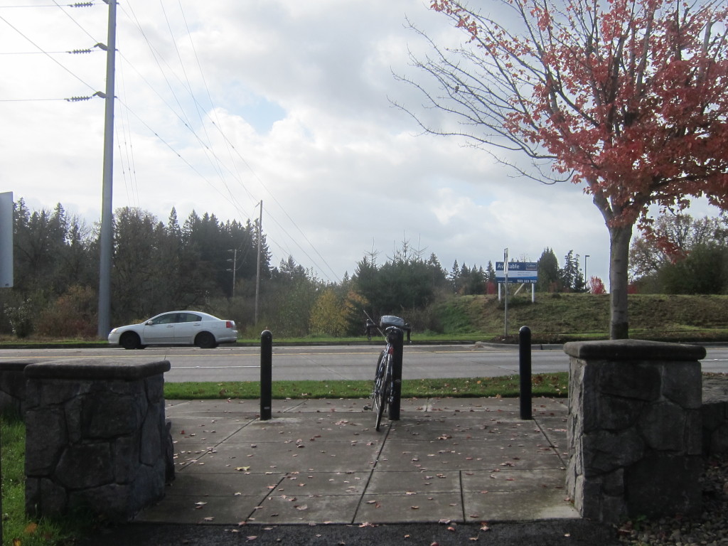
Before I found the start of the real Rock Creek Trail, I took what I thought was the Rock Creek Trail, a multi-use path that runs north/south between NE Butler Street and Rock Creek Blvd. That trail definitely throws you to the wolves. I was super psyched, biking on a pleasant little path along a creek, and then BAM! Four lanes of very fast traffic to cross!
 (the end of the path–until it starts again on the other side, further down the block)
As you can see from the picture there, the path leaves you mid-block, with no safe way to cross other than biking or walking the quarter mile to the next signaled intersection. The other side of the trail actually continues much further down the road to the left of this picture, which means that to get to it, you have to bike the wrong way down the sidewalk until the intersection, wait for the crosswalk there to turn in your favor (which takes a looooong time on these big suburban streets), then bike down the wrong side of the sidewalk on the other side to get back to the path that you had to pass to get to the crosswalk in the first place.
No one really takes that kind of effort. They just wait and run across the street when it seems “safe”–relatively speaking, of course, since traffic is going fast, and there are many lanes of it. That’s certainly what I did. And while it worked out fine for me, I can’t help but think that if the point of a multi-use path is to make space available for families, kids, people out for pleasure, these humongous mid-block crossings that chop a trail into small and disembodied segments make it essentially useless.
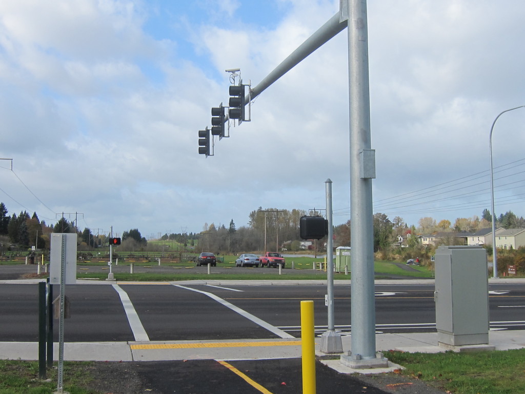
On the other hand, the real Rock Creek Trail has lovely intersections like this:
How nice to get to a mid-block crossing and find a crosswalk! No need to make a choice between either walking or biking down to a distant intersection or taking your chances darting across multiple lanes of traffic–just push the button and wait for traffic to wait for you!
This kind of thing makes a path actually useful. You can follow it for more than half a mile without having to spend 10 minutes detouring just to get across to the next segment of trail. You still have to wait for traffic sometimes, but at least the infrastructure reminds you (and the people driving across the intersection) that walking or biking or running is also a viable use of public space. Trails with infrastructure like this can actually be useful for people who want to go further than the next big intersection.
I think Portland (and the Portland metro area) is going the right direction here–more and more there are signaled intersections like the ones on the Rock Creek Trail; there’s definitely a push to connect all the little orphan pieces of trail scattered about the city. Maybe someday I’ll be able to take a trail all the way from Portland to Hillsboro, the way I can go from Portland to Boring. And then maybe I’ll be able to turn around and get to Mt Hood. That’ll be awesome:)

