
There’s a new scenic bikeway in Oregon–and happily for those of us who live in Portland and don’t like the idea of driving out to a bike ride, it starts in Hillsboro!
The Tualatin Valley Scenic Bikeway doesn’t “officially” open until September 16, but the maps are online and the signs are posted (even if some of them are still covered up). It’s basically ready to go. James and some of our friends and I test rode it this weekend, and it’s pretty rad.
We started by taking the MAX to the Washington/12th Ave stop in Hillsboro, just a few stops from the end of the line. From there, it’s only about 3 miles (albeit somewhat busy ones) to get to the start of the route at Rood Bridge Park. I’d never head of Rood Bridge, but it’s kind of amazing, with a creek and rhododendron garden and everything.
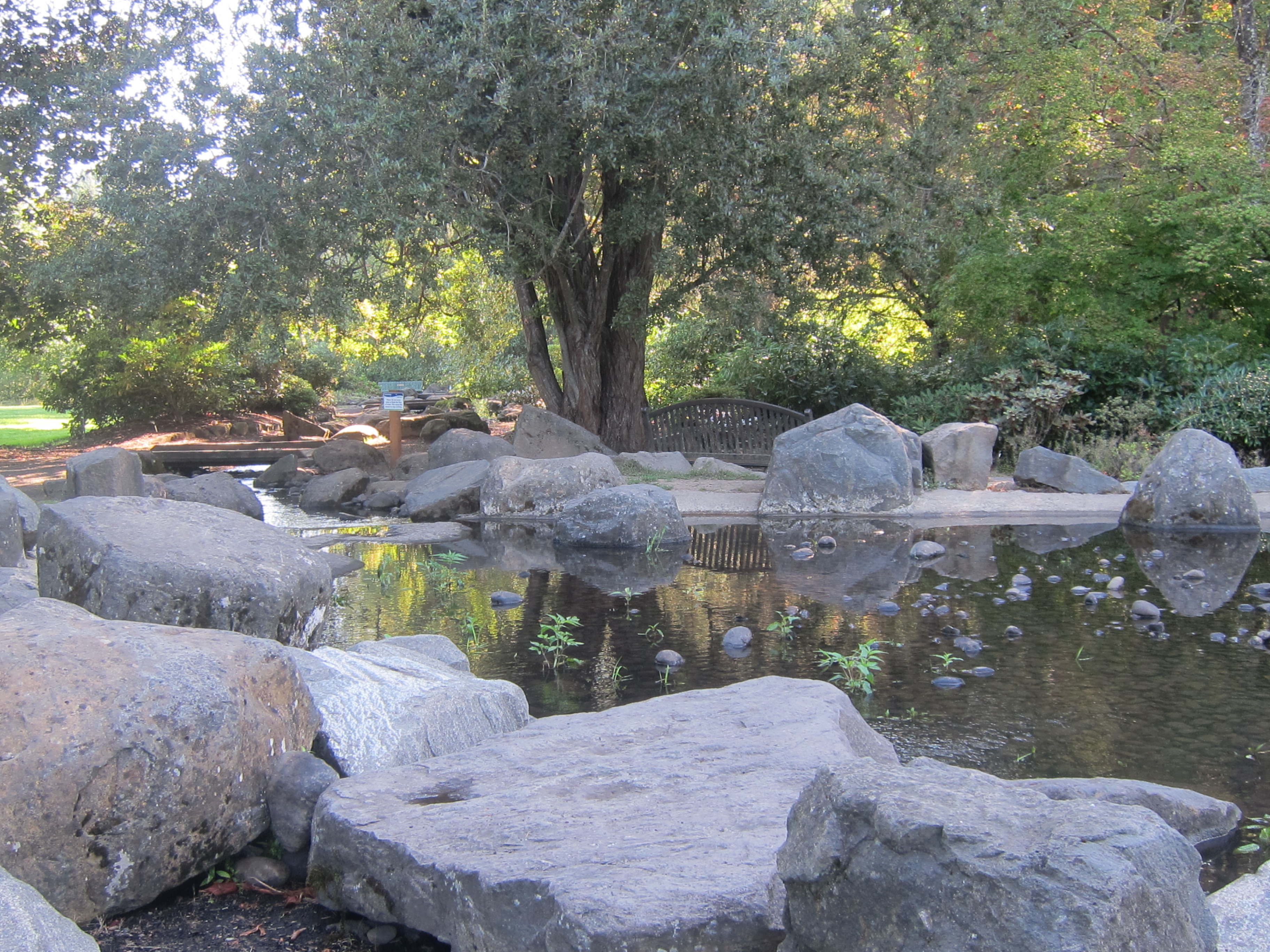 (part of the creek running through Rood Bridge Park)
Even though it’s only 10 miles from Hillsboro to Banks if you take a direct route, this bikeway manages to find a meandering, 30-mile way to do it–first by heading south, then by snaking back and forth across Highway 47 to take advantage of some of the nicer roads. I could see it being a little frustrating if you were simply determined to get to Banks, but in this case the point is not to be efficient, but to enjoy the ride. And it’s definitely nice.
The highway crossings, however, are a little sad. Early into the ride, you cross Highway 219, which has many lanes and feels somewhat sketchy–and then you cross Highway 47 four times before you finally bike on it for about a mile into Banks. We had good luck getting across all of those, but I could definitely see some room for better infrastructure at those intersections. At least some flashing warning lights you could activate before you crossed or something. Or a real median in the middle of 219. I don’t know, but if this ride has a downfall I think the highway crossings are it.
But all that being said, it’s a lovely route. The countryside is gorgeous, and you pass a whole bunch of parks with water and bathrooms and enticing playgrounds. Fern Hill Wetlands is right off the route, so you could even bring your binoculars and do some spectacular bird-watching along the way (we saw pelicans!:) Oddly enough, the route bypasses downtown Forest Grove while coming within maybe a mile or two of it–I would have thought that one would want scenic bikeways to pass through the part of one’s town where people biking might conceivably stop to spend money, but I guess not. I’m not sure why Forest Grove is skipped like that. Though it’s easy enough to detour a little west if you need a snack.
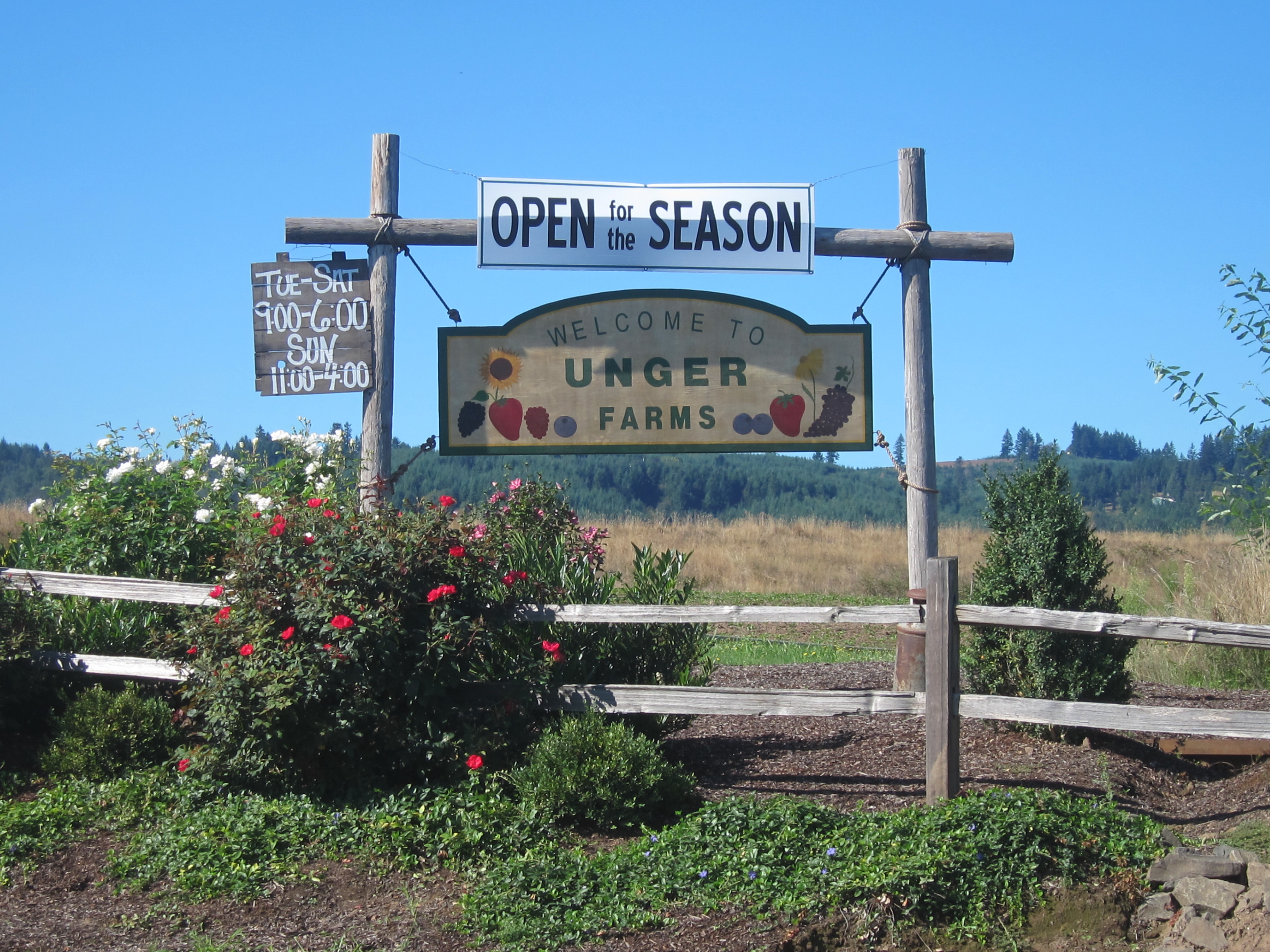 (you also pass a plethora of farm stands along the way, though, that would make an excellent fresh snack without a Forest Grove detour:)
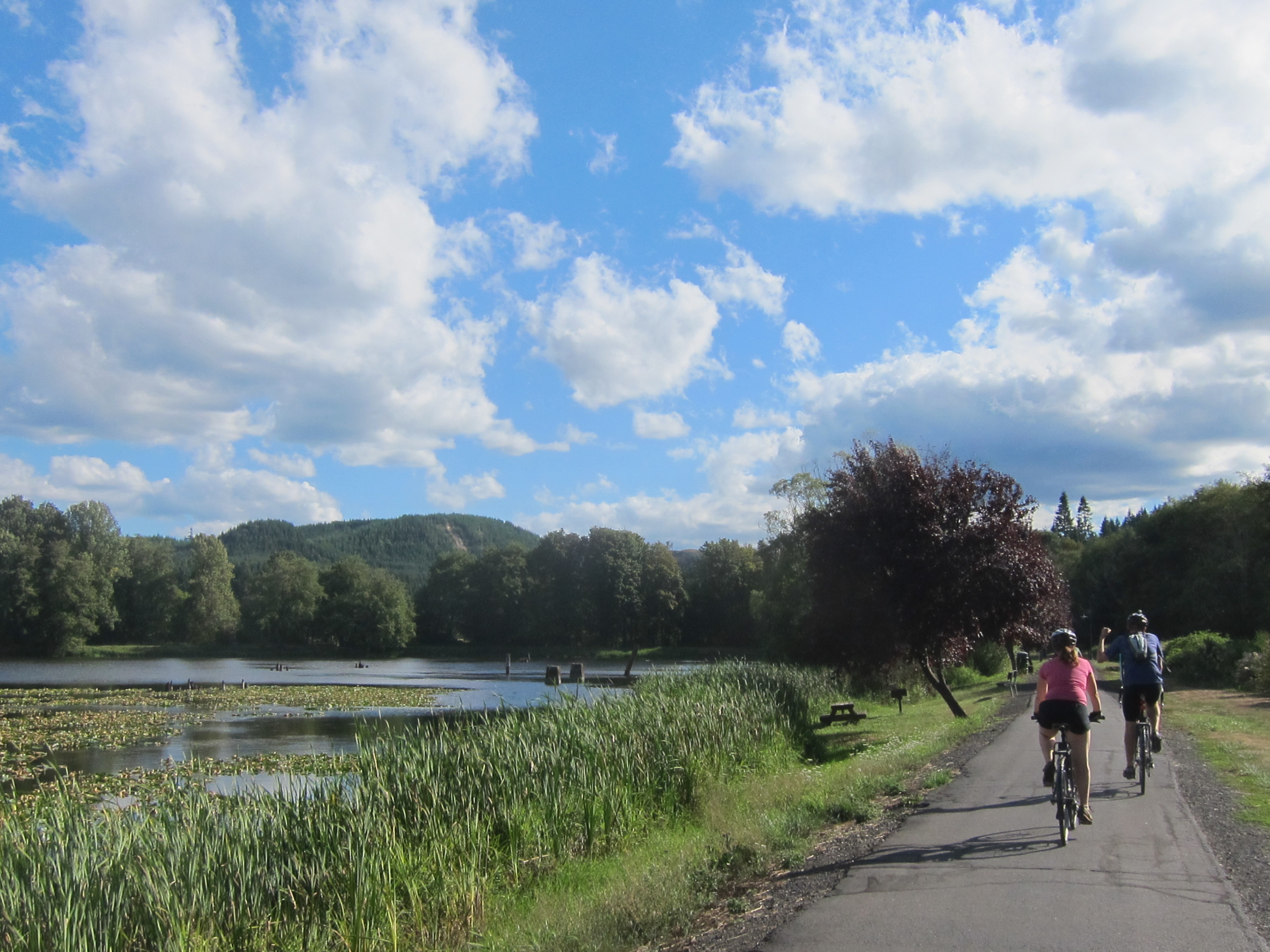
Once you get to Banks, the rest of the 20 miles of bikeway are spent on the Banks-Vernonia trail, a multi-use, totally-separated-from-cars path through the woods. I’ve already written about the B-V trail a bunch on this blog, but I’ll say it again: I love this path. It’s super beautiful, super peaceful, and incredibly kid-friendly since except for a few roads that you have to cross, you never come across any motorized traffic.
 (Seriously. So in love with this path.)
Plus, I have a huge crush on Vernonia, the city at the north of the trail. It’s an itty-bitty town, but it has lots of character, not to mention yummy food and drink options. I’m a big fan of the Black Bear Coffee Company–it has tons of bike parking in the back, lots of outdoor seating on the grass where you can keep an eye on your bike without worrying about needing a lock, and amazing smoothies, food and friendly people. It’s an all-around win:)
Though the scenic bikeway technically ends at Anderson Park in Vernonia, there’s an extra little mile-or-so loop you can take to visit Vernonia Lake (just keep going along the bike path past Anderson Park until you see a sign for the lake). It’s little, but it’s pretty. And nearby, there’s part of the old Vernonia mill–a sight to behold. It’s a shell of a building now being reclaimed by nature, trees growing out of it and everything. It’s eerie and beautiful all at once.
 (lovely trail around Vernonia Lake)
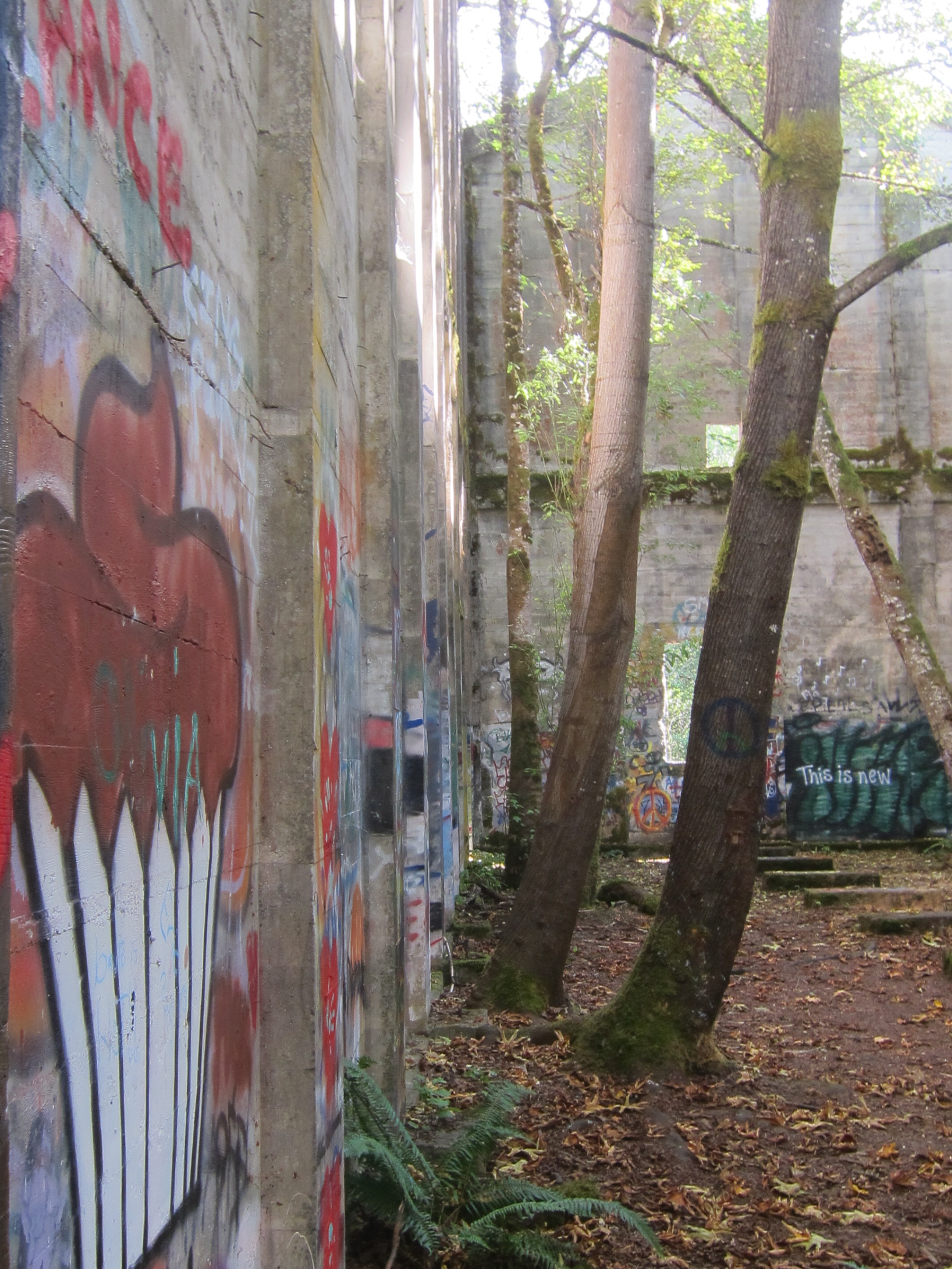 (part of the old mill, reclaimed)
Just to be clear. This ride is 50 miles one-way. To do a full loop, James and I biked back down to Banks on the trail and then took a more direct way back to Hillsboro, for a total of about 80 miles to/from Hillsboro. Then about 9 more to get to the MAX from our house and back again. It’s a big day of biking if you’re not used to going that far. BUT! If you don’t want to go that far in one day, there are options other than a car shuttle. You can camp at Stub Stewart State Park, halfway up the Banks-Vernonia trail. You could stay in Vernonia and bike home the next day. Heck, you could keep on biking to Astoria and make a whole week out of it!:) Or, like one of our friends did, you could cut out the first part of the bikeway and just do the 40-mile there-and-back on the Banks-Vernonia trail. Whatever floats your boat (though I think the bikeway as a whole is pretty rad, and I’m glad I did the first 30 miles too).
I’m psyched that there’s finally a Portland-friendly bikeway, one you can do from the Metro area relatively easily. Once all the signs are uncovered on the 16th, you won’t even need a map to follow it–just hop on and follow the bikeway signs up to Vernonia!
If you’re still curious about it, check out Ride Oregon Ride’s official information about it, or scope my other pictures of it here.
This looks great! Can you ride it before it’s officially open?
Yes- anyone can ride it now. As Stasia mentioned, a few of the signs are still covered up awaiting the big kick off event on Sept. 16th. Just take a map with you- maps are at http://www.oregon.gov/oprd/BIKE/Pages/TVSB.aspx
Alex
PS Info on the Sept 16th event: http://www.oregonswashingtoncounty.com/events/view/39f07b33-6e71-4661-bae0-95830349e13a/
Thanks for the response, Alex:)
Karen, now that I look at the links Alex provided, I feel like you should wait until the day it officially opens and then ride it with a bunch of other happy people AND get refreshments! :)
That trail around Vernonia Lake looks beautiful. Sorry to say I’ve been on the Banks/Vernonia trail a few times and never even knew that part existed.
Woah, really? You should definitely check it out. Heck, you could even go fishing! :)
But seriously, you would love that old mill. It’s a great relic, plus a great reminder that we’re only temporary inhabitants here.
Pingback: Stub Stewart cabin camping: escapism or revitalization? :) – CarFreeRambles
Have a good map of your shorter (12 mile) route from Hillsboro to Banks?
Yep! Here: