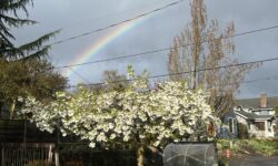
The hazard of spring bike trips in Oregon

Oh, Oregon.

It’s true–both these pictures are from the same 3-day bike trip:

stasia bike trip contrast

On Monday when I left, it was a good 70 degrees and sunny. The next two days? Rain, rain, rain. And cold. I guess in this picture I hadn’t put on my beanie and extra sweatshirt layer yet:)

Knowing Oregon, of course I’d packed for the inevitable wet and cold. But still. When I biked past a bank in Estacada today with one of those time/thermometer signs, I was a little incensed to see that it read 45 degrees.

Fun dualities: for the last hour or so before I made it home today, with my hands so wet and numb that I couldn’t even reliably shift gears, I could still, from two days before, feel the heat radiating from a sunburn on my back.

Like I said, this is the hazard of springtime travel in Oregon:)

the psuedo-science of packing:)

Mini bike adventure time!

I’m heading out tomorrow for just a few days, which means that today I’ve slowly been adding to a pile of stuff on my floor:

bike trip packing

This is what my house always looks like before I leave: a collection of the things I want to bring with me, all spread out on the floor. I sort of gather things as I think of them and lay them out so I can see what I have and what I still need. And then right before I leave, I finally consolidate it all and put it efficiently in my trailer in exactly the way I like.

This is my pseudo-scientific method of packing:)

And no, if you were curious, that big blue bag doesn’t stay that large. (A trailer can take big things, but that bag would be an egregious misuse of space;) That’s my sleeping bag, which I will compress down to a reasonable size tomorrow morning before I go.

So excited! Think me happy thoughts for good weather!

Metolius River Loops Scenic Bikeway

I mentioned last time that if you’re in the Sisters/Bend area, you have all sorts of different Scenic Bikeways to choose from. Many of them are just one route, from point A to point B, or, like the Twin Bridges bikeway, a loop. If you want a ride with lots of different options, though, including some short, kid-friendly ones, the Metolius River Loops Scenic Bikeway is a good bet.

metolius river bikey(just chillin’ in front of the Metolius River)

It’s called the Metolius River Loops Bikeway because it does, in fact, have a bunch of different loop options. The shortest one is just over 3 miles, much of which actually has separated bike paths that roughly parallel the road. They’re unpaved, which I know can be anathema to road biking, but the quality of the path is good, and they’re pretty. I actually preferred them to the roads since in a scenic place I’m not necessarily trying to go fast anyway. And they’re fine for skinny tires.

metolius bike path(One of several lovely bike paths. Totally worth it)

The longest official loop, the one that has a spur up to the Lower Bridge campground, is 14.6 miles. But honestly, since all the loops sort of overlap each other and it’s hard to differentiate which is which from the overview map, and since there are no signs on this bikeway (yet!), I didn’t really follow any specific loops. What I did, and what I’d recommend doing unless you definitely have a 5-year old with you and need to keep to 3 miles or whatever, is just to treat this bikeway as an exploration: use Camp Sherman as your starting point, and then simply follow all the awesome roads that you can. There aren’t that many, so as long as you’re conscious of which direction the river is in and which direction you came from, I think it’d be very difficult to get lost for too long.

My absolute favorite part of this bikeway isn’t actually mentioned on the bikeway cuesheet itself but is a little detour you can take to go see the headwaters of the Metolius River. If you follow the “headwaters” signs, you’ll get to a little paved path; you can bike all the way down it (just watch out for pedestrians!) until you see this:

metolius n jefferson(Mt Jefferson! And check out how big the Metolius River is)

After that, turn around and look upriver, and you’ll see this:

metolius headwaters

Yep. I couldn’t take a good picture of it, but that’s the Metolius River, springing forth fully formed from the ground. It is absolutely amazing to me that the huge river you see on all of this bikeway spews forth from underground right here. And you can see it. Rivers being born is one of the most amazing things ever.

Other than the fact that it’s a super lovely place to ride (you can’t go wrong with the many places to play in the river and all the Ponderosa forest), another fun thing about this bikeway is that there are campgrounds all over the place. They’re not marked on the bikeways map, but you seriously can’t go for more than 30 minutes on your bike without stumbling over another campground. Most of them are right on the river; most of them are also relatively small and peaceful. And you’re never too far from Camp Sherman, where there’s a friendly store if you run out of food. It would be really fun to come out here and set up a base camp somewhere, then spend a day or two exploring everything else the area has to offer.

For that matter, if you’re not into camping, there are also a plethora of lodges that you pass on the way in to Camp Sherman. This bikeway might seriously have something for everyone. Except for steep hills:)

mountain(though like any self-respecting place in Central Oregon, it does have mountain views:)

So this is by no means a challenging ride, but it is a lovely one, with lots of different options for one day or more. And you can’t go wrong when you’re on such a lovely river as the Metolius. I’d totally recommend it.

Twin Bridges Scenic Bikeway

Deschutes River(dramatic weather over the Deschutes River near Bend, Oregon)

The background

Ever since I went to the Scenic Bikeway conference back in April, I’ve been itching to ride around on the bikeways I haven’t seen yet. Combine this with a recent intense desire for adventure and newness and open roads and non-mechanized space, and you have a recipe for stasia-in-foreign-lands.

I took two days to hang out in the Bend/Sisters area, camping at Tumelo State Park (which has a $5 hiker/biker site, $21 regular tent sites along the Deschutes River, and $39 yurts) and exploring some of the four Scenic Bikeways that go through the area.

The ride

The Twin Bridges Scenic Bikeway starts and ends in Bend, OR at Drake Park. It’s right downtown, which is handy not only for pre-ride fueling but also for all the post-ride food and brewery options.

Drake Park(Drake Park is on a dammed part of the Deschutes River, and, like all things around Bend, offers amazing mountain views:)

The ride itself is a 36.2 mile loop that does, in fact, take you over the Deschutes River twice, over twin bridges (you can find the map, cue sheet, and other details at the Ride Oregon Ride site). The roads are pretty quiet, traffic-wise, except for a short (.3 mile) stint on Highway 20 and the initial road out of downtown, both of which have good shoulders. And actually, this isn’t mentioned on the cue sheet, but Galveston Road, the road out of Bend, has a parallel and separated bike path that you could take instead of the road itself.

There are only a few parts of the whole route where you can’t see mountains. The Three Sisters are the most prominent, but Broken Top, Jefferson, and Washington all make appearances at some point or another.

sisters on the bikeway(mountains: typical bikeway scenery–in this case, north and middle sister:)

Combined with the high desert Ponderosa Pines, the river, the fun geology, the quiet if somewhat roughly paved roads, and the decidedly un-Portland landscape, it makes for a very nice ride.

Though mileage-wise you could finish the whole route in 2 or 3 hours, I had a really fun time making stops along the way, both to take pictures and to hang out in places that seemed fun. Shevlin Park, for example, is a lovely place that you pass twice on the loop. Tumelo Creek, quite cold, runs through it, and there are miles of running, hiking, and mountain bike trails to explore. It was an excellent snack-and-explore stop for me, and even though I could only wade into the creek for a few seconds before my feet turned numb, I still had a good time wading in, then out, then in again for as long as I could handle it:)

There are also tons of places just to pull off the road and marvel. Or watch birds. Or count clouds. Or do whatever it is you love about being in nature. Which, without consciously knowing it, is exactly what I needed out of an adventure.

The other cool thing, something that I noticed when I was biking through here on my way to Tahoe last year too, is that people in Bend seem pretty used to both seeing and being cyclists. Everyone I met was friendly and courteous on the road, which always makes for a more pleasant experience.

crows feet bike(and right at the end of the bikeway, not only do you go right past Bend Brewing Company but you also pass this awesome bike/coffee/beer/hangout place right at the edge of the park:)

But the best part…

But the best part isn’t the amazing views, the good biking, the cute downtown Bend shops, or the sense of openness and possibility out here. It’s that if you’re out near Bend for this bikeway, there are three others not too far away: the McKenzie Pass, Metolius River, and Sisters to Smith Rock bikeways all start near Sisters just over 20 miles away from Bend. It’s a bikewaystravaganza out there in central Oregon.

I have plenty more pictures, of course, both of the bikeway itself and all the fun stuff you can access from Tumelo State Park. Check them here if you want to get inspired for your own adventure:)